
A – Z Guide to Lewis Smith Lake Map
Your Quick Guide to Finding a Lewis Smith Lake Map
Finding a lewis smith lake map is the first step to making the most of this stunning Alabama reservoir. Here are the best options at a glance:
Top sources for Lewis Smith Lake maps:
- Kingfisher Maps (kfmaps.com) — Waterproof, tear-resistant paper map (#106), 24×36 inches, 20ft contour intervals, scale 1:50,000, GPS compatible
- Keith Map Service (keithmaps.com) — Waterproof fishing map with marinas, structures, and road details
- iBoating App — Digital fishing and navigation app with HD depth contours, GPS tracking, and lake temperature layers (Android, iOS, Mac, Windows)
- Smith Lake GPS App — Interactive mobile map with marinas, boat ramps, neighborhoods, and points of interest
- Sue Clements’ Google MyMap — Free community-built map with categorized landmarks, launches, marinas, restaurants, and more (accessible via the “Exploring Lewis Smith Lake” Facebook group)
- USGS Topo Maps — Free topographic reference maps with elevation and geographic coordinates
Lewis Smith Lake is one of Alabama’s most impressive bodies of water. Spanning over 21,000 acres across Cullman, Walker, and Winston counties, it reaches a maximum depth of 264 feet — making it the deepest lake in Alabama. With more than 500 miles of shoreline and a complex “three-fingered” shape, navigating it without a good map can be genuinely challenging — whether you’re boating, fishing, or just exploring by pontoon with the family and dogs in tow.
I’m Tim Morgen from 2Poochies Properties, and after years of helping families and their pets experience true lakefront living on Lewis Smith Lake, a reliable lewis smith lake map has been one of the most common questions I get from guests. In this guide, I’ll walk you through every map option worth knowing about.
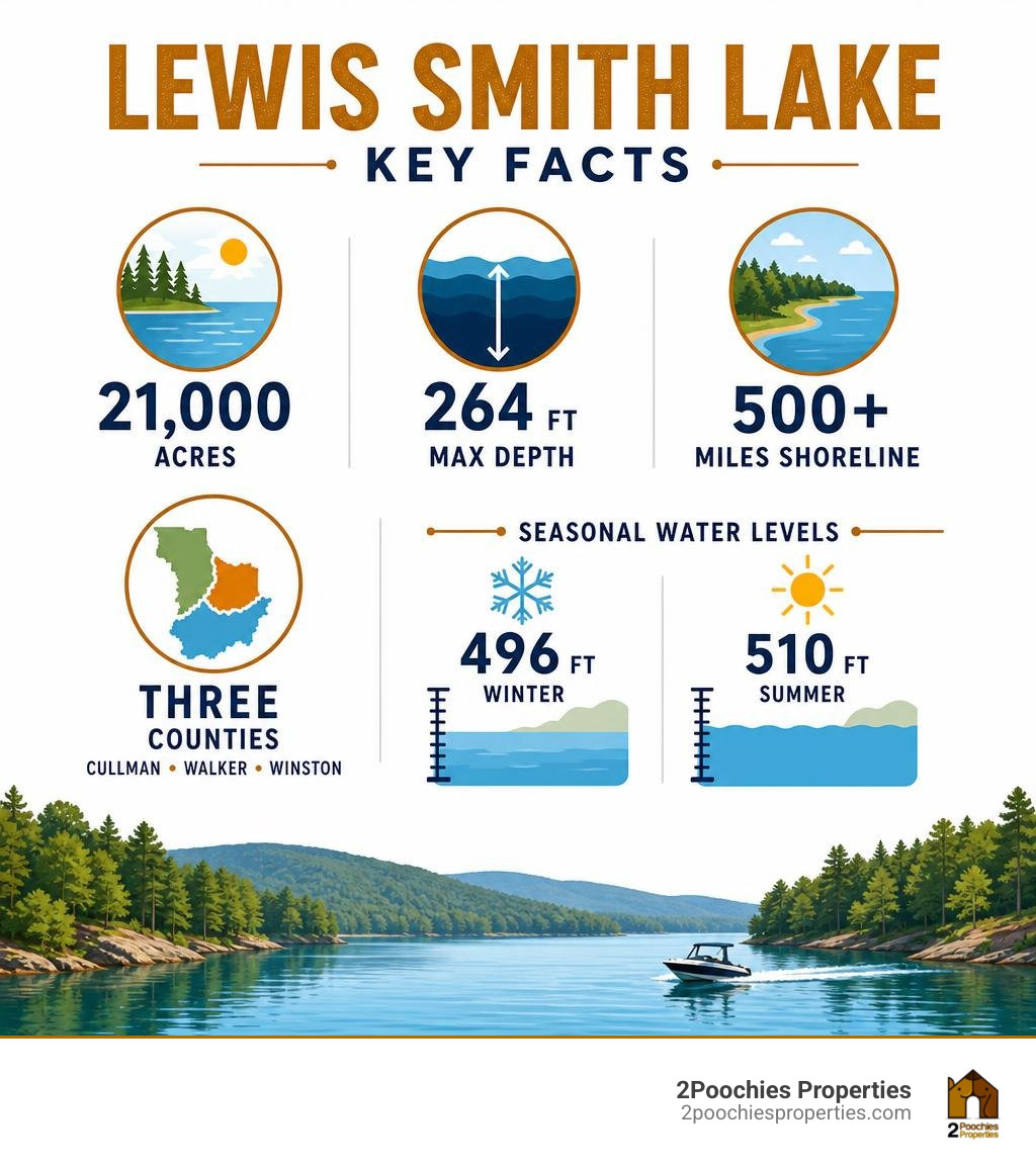
Know your lewis smith lake map terms:
Essential Features of a Lewis Smith Lake Map
When you are out on a body of water as vast and deep as Lewis Smith Lake, a standard highway map simply won’t cut it. To navigate safely, you need a map that highlights the unique geography and underwater topography of this three-fingered reservoir.
One of the most critical elements of any high-quality lewis smith lake map is the inclusion of detailed depth contours. Because the lake was created in 1961 by the construction of the massive Lewis Smith Dam, the underwater landscape is filled with steep drop-offs, submerged ridges, and old creek beds. A map with clear depth markings helps boaters avoid shallow hazards and helps anglers locate the deep channels where spotted bass love to hide.
Another essential feature is the depiction of the lake’s water level. Lewis Smith Lake has a full pool elevation of 510 feet above mean sea level. However, because the lake is managed for both recreation and peak-load power generation, the water level fluctuates seasonally. A good map will show you the difference between the summer pool (510 feet) and the winter pool (typically around 496 feet). Understanding these fluctuations is key to finding safe launch points and avoiding newly exposed sandbars or shallow banks. For real-time updates on how these changes affect your boating routes, you can read our guide on How to Check Smith Lake Water Level Quickly.
Finally, a practical map must show the locations of lakefront homes, local landmarks, and public access points. Whether you are searching for your rental home from the water or trying to find the nearest marina for a quick fuel up, having clearly labeled bridges, sloughs, and county lines makes navigation a breeze.
Top Physical and Paper Maps for Navigation
Even in our digital age, keeping a physical, paper map on your boat is a smart safety measure. Mobile phone batteries can die, and signal coverage can be spotty in some of the deeper, forested canyons of the Sipsey Fork. A reliable physical map is always ready to use.
The gold standard for physical lake navigation is the Lewis Smith Lake Waterproof Map #106 – Kingfisher Maps, Inc.. This map is specifically designed for the rugged conditions of active boating. Printed on waterproof and tear-resistant paper, it can handle getting splashed on the deck of a pontoon boat without falling apart. It features a scale of 1:50,000 and uses 20-foot contour intervals to give you a highly detailed look at the underwater terrain. It is also GPS compatible, meaning you can easily cross-reference coordinates from your hand-held GPS unit.
Another excellent physical option is the Lewis Smith Lake Fishing Map #106 – Keith Map Service, Inc.. This publication is highly regarded by local anglers and boaters alike. It provides detailed layouts of local marinas, structural features beneath the surface, and the surrounding road networks in Cullman, Walker, and Winston counties.
Choosing a Paper Lewis Smith Lake Map for Boating
When choosing a paper map for general boating, look for options that prioritize clear visual markers. The three main branches of the lake — the Sipsey Fork, the Ryan Creek branch, and the Rock Creek branch — can look surprisingly similar if you are new to the area.
Your map should clearly label major bridges, power lines, and navigational buoys. It should also highlight the locations of full-service marinas where you can pull up for fuel, snacks, or emergency assistance. A map that includes local road networks leading down to the public boat launches is also incredibly helpful for planning your land-to-water transition.
Topographic Details on a Lewis Smith Lake Map
For those who want to understand the true geological makeup of the area, topographic maps are invaluable. The lake sits at an elevation of approximately 501 feet (153 meters) above sea level in its natural state, surrounded by the rugged, rolling hills of northern Alabama.
To see the exact topography of the shoreline and the surrounding watershed, you can consult the Lewis Smith Lake Map – Walker County, AL. This USGS quadrangle map provides incredible topographic detail, showing the historical elevation contours of the land before it was flooded in 1961. It is an excellent resource for hikers, history buffs, and anyone wanting to understand the deep-water channels of the Sipsey Fork.
Digital and GPS-Enabled Mapping Options
If you prefer to navigate using your tablet or smartphone, there are several fantastic digital mapping options designed specifically for Lewis Smith Lake. These apps turn your mobile device into a high-powered marine chartplotter.
The Smith Lake GPS 4+ App is a popular choice among locals and visitors. Developed with input from local real estate and boating experts, this app offers real-time GPS tracking as you move across the water. It helps you quickly identify whether you are in Rock Creek or Ryan Creek, points out famous local landmarks like the “Smiley Face House,” and shows you the exact direction to nearby marinas and public launches.
For a more technical marine navigation experience, the Lewis Smith Lake Fishing Map | Nautical Charts App by iBoating is top-tier. This app is supported across iOS, Android, Windows, and Mac platforms. It offers advanced features such as:
- HD lake depth contours
- Custom depth shading to easily identify shallow areas
- Water level offset adjustments to match the current lake elevation
- Live instrumentation data, including GPS tracking and route assistance
Interactive Maps for Anglers
Anglers need more than just navigational aids; they need to know where the fish are holding. Digital maps designed for fishing allow you to overlay depth charts with structural details like submerged roadbeds, rocks, and timber.
For a comprehensive database of coordinates, you can access the Lewis Smith Lake Alabama US GPS Fishing Spots (920+). This service provides over 920 specific GPS waypoints within a 35-mile radius of the lake, including artificial reefs, deep ledges, and natural underwater structures. You can easily download these points as GPX or KML files and import them directly into your boat’s fish finder or GPS unit (such as Garmin, Lowrance, or Humminbird).
To make the most of these coordinates, be sure to pair them with local angling strategies. You can read our expert advice in The Ultimate Guide to Lewis Smith Lake Fishing and learn how to navigate the deep waters like a seasoned veteran by checking out Fishing Lewis Smith Lake Like a Pro.
Navigating Key Points of Interest on the Lake
With over 500 miles of shoreline, knowing where the key points of interest are located will save you hours of wandering on the water.
One of the most popular areas on the lake is Crane Hill, Alabama. Located on the eastern side of the reservoir in Cullman County, Crane Hill serves as a fantastic base camp for lake adventures. It is home to beautiful parks, local dining, and excellent boat launches. You can learn more about this charming lakeside community through the Crane Hill, AL: Appalachian Lakeside Oasis | Alabama Travel guide.
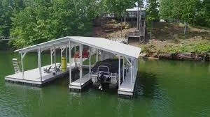
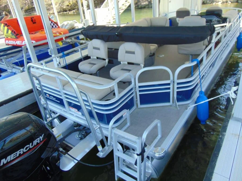
When planning your route on your lewis smith lake map, make sure to mark the key marinas. Marinas such as Duskin Point and others scattered across the tri-county area (Cullman, Walker, and Winston) are essential stops for refueling your pontoon boat, grabbing a hot meal, or picking up extra sunscreen.
Family and Pet-Friendly Lake Access
If you are visiting the lake with your family and your four-legged friends, you’ll want to plan your map route around safe, pet-friendly access points. Swimming is one of the absolute best activities on Smith Lake thanks to its exceptionally clean, clear water.
When mapping out your day, look for quiet, sheltered sloughs away from the heavy traffic of the main channels. These calm pockets of water are perfect for anchoring your pontoon boat, setting up a swim dock, and letting the kids and dogs splash safely in the water. For a list of great spots that combine excellent swimming with quiet banks, take a look at The Best Fishing Spots on Smith Lake for Every Angler.
To help plan your entire stay, including where to park your boat trailer and find pet-safe accommodations, check out our Smith Lake Vacation Rentals.
Frequently Asked Questions about Lewis Smith Lake Maps
What is the deepest part of Lewis Smith Lake?
The deepest part of Lewis Smith Lake is located directly in front of the Lewis Smith Dam, reaching a maximum depth of 264 feet. This makes it the deepest lake in the state of Alabama. The dam itself is a massive earthen structure, stretching 2,200 feet in length and rising 300 feet high. You can read more about the history of the dam’s construction and its role in northern Alabama’s power grid on the Lewis Smith Lake – Wikipedia page, or view quick geographical statistics on the Basic Facts Smith Lake – THE LAKESIDE LIFE resource page.
Where can I find a free interactive map of the lake?
A fantastic free interactive option is the community-created Google MyMap, which was originally compiled by a dedicated local resident. This map organizes hundreds of points of interest into easy-to-use, color-coded categories, including public launches, bridge heights, local landmarks, and lakefront restaurants. You can find links to this map and other excellent local mapping resources on the Map of Smith Lake – THE LAKESIDE LIFE page.
How do seasonal water levels affect lake navigation?
Because Alabama Power manages the lake’s water levels, the shoreline changes significantly between seasons. At full summer pool (510 feet), navigation is generally straightforward, and most hazards are well submerged. During the winter drawdown (down to 496 feet), shallow points, sandbars, and rock ledges that were safely underwater during July can sit just inches below the surface. Always adjust your digital map’s water level offset or consult local level charts before heading out in the cooler months.
Conclusion
Navigating the deep, winding waters of Lewis Smith Lake is an unforgettable experience, but it requires the right tools. Whether you choose a rugged, waterproof paper map from Kingfisher Maps to keep on your boat’s console, or a high-tech GPS app like iBoating to track your route in real time, having a reliable lewis smith lake map ensures your days on the water are safe, relaxing, and fun.
At 2Poochies Properties, we specialize in providing pet-friendly lakefront vacation rentals designed for the whole family. Our homes feature pet-safe designs with fenced areas, durable flooring, and professional cleaning to ensure allergy-free stays for every guest. We even offer boat rentals to help you get out on the water and explore the gorgeous three-fingered layout of Smith Lake firsthand.
By booking your stay directly with us, you can bypass third-party fees and save on your next Alabama lakefront getaway. Ready to start your next adventure? Book Your Pet-Friendly Smith Lake Stay with us today and let us help you map out the perfect vacation!